
A Short History of The Itchen Navigation in Compton & Shawford
 The River Itchen (earlier also known as the River Alre) has a total length of 28 miles (45 km), and is noted as one of the world’s premier chalk streams for fly fishing. The Itchen Navigation and River Itchen hold a thriving population of fish, particularly brown trout, grayling, pike, eels and minnows and is of international importance for its floating vegetations and Southern Damselfly populations. The local chalk aquifer provides excellent storage and filtration and the river has also long been used for public water supply. Indeed the Itchen Navigation, in the mid 19th century, made more money from selling water than it did from tolls! The ford at Shawford was probably the oldest and most used of all the routes across the Itchen. It was busy by the time of Stonehenge, pre 2000BC. Its course across the valley made use of the island of firmer ground in the centre of the valley floor; most of this appears to be gravel, with perhaps softer ground on the Shawford side. At this time, before the Shawford Mill, the flow would only have come from spring lines along the Western edge of the valley along the boggy line at the bottom of the Station Lane gardens; it would have flowed as a winter bourne. So a short causeway would have sufficed for the crossing of any soft ground.

The river had been commercially important since before Norman times, with a staithe for unloading boats recorded at Bishopstoke in 960, and stone for Winchester Cathedral, built when Winchester was the capital city of England, was probably transported by water from the quarries of Caen in France. The first recorded improvements to the river were made by Godfrey de Lucy, who was Bishop of Winchester between 1189 and 1204. He funded the formation of a ‘vast mole’ or head, and created the lake at Alresford now called the Alresford Pond. As a consequence, he was granted the right to levy tolls on goods transported on the river by King John. His intention was to make the river navigable from Alresford to Northam. There was considerable trade in wool and leather, but the centres for this moved to Calais and Melcombe Regis in 1353, and as the trade declined, so did the navigable parts of the river. It was noted to be in poor condition in 1452, and a report for the Commissioners of Sewers in 1617 suggested that much of it was obstructed by mills which had been built on the banks.
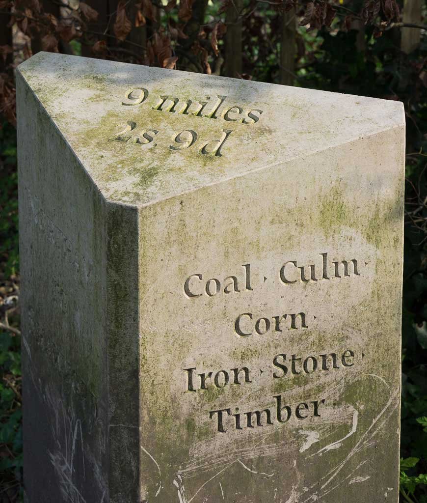
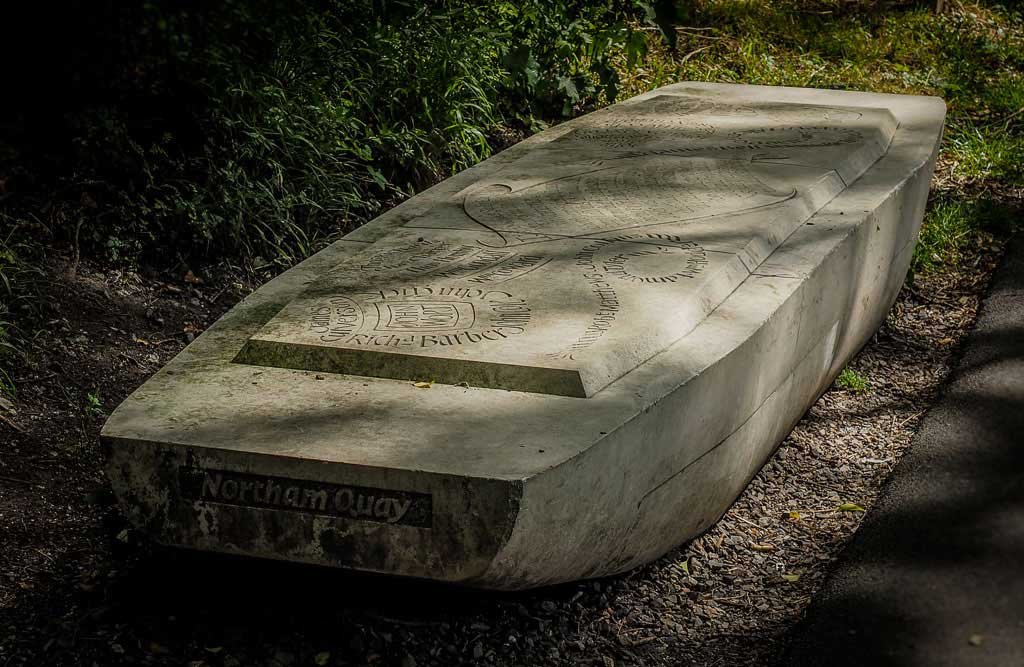
The Itchen Navigation is the 10.4-mile (16.7 km) disused canal system utilising the river and provided an important trading route from Winchester to the sea at Southampton for about 150 years. The Itchen bridges prevented masted vessels of any size from going further upstream. Improvements to the River Itchen as a waterway were authorised by Act of Parliament in 1665 in the reign of Charles II, but progress was slow, and the navigation was not declared complete until 1710. It was known as a Navigation because it was essentially an improved river, with the main river channel being used for some sections, and cuts with locks used to bypass the difficult sections. Although never heavily used it provided an important method of moving goods, particularly agricultural produce and coal, between the two cities and the intervening villages.
The value of the Navigation was not only transport but also winter irrigation and summer drainage of the adjoining water meadows. The length of the Navigation between the junction of the millstream just above Shawford Bridge and Twyford Lane End Lock, near the present Motorway, used the river course rather than an artificial cut. Twyford Lane End Lock is now overgrown and difficult to visualise as the river was diverted to its present course in a new cutting with the building of the M3. Just below this point, at Tumbling Bay Hatches, the flow to the Twyford Drain is regulated by these hatches (sluices). This Drain is a branch of the River which flows through Twyford. It is the Navigation flowing down to Compton Lock (previously called Compton Bay Lock or Twyford Lock) which forms the eastern border of the Parish separating Shawford from Twyford.
On completion of the Navigation it was capable of taking shallow barges of around 13 feet (4.0 m) in width and 70 feet (21 m) in length, but traffic was fairly modest. Only 18,310 tons of freight were carried in 1802, one of the better years, and there were never more than six boats in use on the waterway. Following the opening of the London and Southampton Railway in 1840, traffic declined sharply, and the Navigation ceased to operate in 1869. There were various attempts to revitalise it, but none was successful.
The information above was largely obtained from The Itchen Navigation by Edwin Course, The Five Mills of Twyford by C. Corcoran and Wikipedia. For the History of Shawford Mill built in 1785 and the ford at Shawford please see: https://lhs.comptonshawford.uk/2017/04/the-five-mills-of-twyford-in-1300/
There is a further interesting article “The Itchen Navigation: A Lawyer’s View” by Alec Samuels. https://www.hantsfieldclub.org.uk/publications/hampshirestudies/digital/1980s/vol38/Samuels.pdf
The Itchen by Train & bus Leaflet has a map of the whole route of the Itchen Navigation, with some historical information..
The Viaduct Way, which starts at Hockley Viaduct in the parish of Compton & Shawford and leads into Winchester, follows closely the route of the Navigation.
The above two download links point to leaflets hosted on external sites over which we have no control, so the links may change.
Peter Betts
09/12/2018
This article appeared in the Compton & Shawford Parish Magazine, January 2019 edition.
