
Table of Contents
The Ancient Roads of Compton
Introduction
Local historian J.S.Drew wrote this series of articles on The Ancient Roads of Compton while the original Winchester bypass was being built just before the Second World War.
After an earlier plan to build a single-carriageway bypass had been abandoned, construction on the dual-carriageway bypass began in late 1935. The completed bypass was fully opened for traffic on 1 February 1940.
These articles appeared in the Compton Parish Magazine over the five months from September 1937 to January 1938.
We are grateful to the Hampshire Records Office whose archive contains most issues of the Parish Magazine since 1928. You can find the issues in question under references 1M76/PZ8/4 and 1M76/PZ8/5.
The Ancient Roads of Compton (1)

Reproduced from the Compton Parish Magazine, September 1937
At the present moment there is going on in our midst a greater activity in road-building than Compton has seen since the Roman engineers carried their great road right through our parish, and it seems therefore opportune to set down, as far as may be, what is known (and, almost as important, what is not known) about the ancient thoroughfares of this place.
The road-system of any parish which lies, as ours does, between two important towns is determined by three things : the physical characteristics of land and river, the needs of through traffic and the requirements (usually mostly agricultural) of the local inhabitants. Here, the salient physical conditions in early days can be stated very simply. The northern half of the parish, being on chalk, was mostly hare of trees and man could move about freely and cultivate the soil almost were he chose. The southern half, being on clay, was covered with forest so dense that man’s access to it was limited at first to some few places where the undergrowth happened to be growing less thickly. As to the river Itchen, the only point germane to our present subject is that the old western channel, which forms the eastern boundary of the parish, was fordable apparently only at Shawford (perhaps from Middle English Schaldford, “ the shallow ford ”), and that this ford was of importance to the whole district as being the southernmost river-crossing in the chalk country.
One would naturally expect to find our very earliest traffic-ways in the open chalk land, and Compton and Shawford Downs are, in point of fact, a veritable complex of tracks and hollow-ways. Of these, some are very recent, some mediaeval and the position of a few suggests a very early origin indeed. Mr. C. F. C. Hawkes, the well-known archeologist, who examined this area in 1925, says “ From Silkstead an old lane runs northward to Yew Hill ; there are traces of it as far south as Hocombe Bridge, and Isaac Taylor shows it coming from Toot Hill, near Southampton, by way of Chilworth. It is not a ridgeway, but there are many hollow tracks on Yew Hill, and the road which goes north thence past Oliver’s Battery (now partially obliterated by Pitt Corner Camp) looks like one and must have joined the South Hants ridgeway on Teg Down or Sleeper’s Hill just above Winchester….. From Yew Hill hollow tracks lead down to the Itchen at Shawford and beyond…..White Lane marks the continuation of this branch.” The point of all this is that over 2000 years ago the ridgeways, running along the tops of the downs, where the arterial roads of southern England, and if the focal point at Yew Hill was connected with one of them, then these tracks of ours are of prehistoric origin and probably in use when St. Catherine’s Hill was a populous town. And this, slight and conjectural as it is, is all that can be said at present of Compton’s earliest traffic-ways.
With the Roman occupation we reach much firmer ground. As part of a general programme of road construction, conceived on a scale vast enough to warm the heart of Mr. Hore-Belisha, a road was laid out in a straight line from the south gate of Winchester to Otterbourne, where it forked, the eastern branch leading to the fortified port of Clausentum (now Bitterne), and the western branch crossing the Test at Nurseling and then turning in the direction of Dorchester. Here, from the railway bridge to the golf links the levels have been much altered in the last 150 years, and whatever remains of the Roman road probably lies under the present main road. In the southern section however definite traces were evidently visible 25 years ago. Mr. O. G. S. Crawford, a good authority, wrote in 1914 – “ This road follows the modern Winchester and Southampton main road for four miles. I have traced it southward from the golf links near Shawford Station. Signs of it are visible beneath the hedge of the modern road down the long hill into Otterbourne on the east side. The entrance gates of a number of new villas are built upon it.” Short of actual excavation, by means of a trial trench, this is about all that can be said ; but what a chance it is for someone through whose garden it passes to fix the exact site and demonstrate the method of construction. Incidentally we may note that when the road-makers came over the brow of the hill they faced the edge of the forest, through which they cut a belt. Doubtless the first piece of systematic deforestation in this place.
It will be convenient here to describe the later history of this road. No doubt it was kept in good repair while the disciplined Roman administration lasted, but the succeeding centuries saw a progressive deterioration. The traffic between Southampton Water and Winchester was probably always too great for bushes and trees to grow up in the roadway as happened in many parts of the country, but rain, frost and the looting of the rubble core for building purposes had their inevitable result. At any rate, traffic began to follow a line slightly to the east of the old road, and so, in course of time, was formed the sunken way (known in the Middle Ages as the Holeway or Holloway) which forms such a feature of the gardens through which it now runs. In early days the trees of the forest and, later on, the very depth of the sunken way prevented traffic from diverging, however much water and mud may have afflicted the loaded pack-animals or worn out the tempers of long-suffering carters : but where the road debouched on to the open down more latitude was possible, and as one track became unusable another was formed. This accounts for the fan-like complex of hollow ways we see on the golf links.
In later centuries the road became more stabilized and the inhabitants of Compton (who were responsible for its upkeep in their parish) were frequently ordered by the Hundred Court to effect repairs. The present road from the top of Compton Hill to Otterbourne was constructed about 1760 and, as we have seen, its course followed very closely the line of the original Roman road. Before the cutting by the Wayside Cross and the causeway in the dip were made the hills must have been exceedingly steep, but the writer has not been able to discover the date of these improvements.
The Ancient Roads of Compton (2)
Reproduced from the Compton Parish Magazine, October 1937
The Dark Ages, when Roman dominion had ceased and the Saxons were slowly conquering the country, are, from the point of view of roads, very dark indeed, and it is not for several centuries (say, until about King Alfred’s time) that we begin to see daylight again.
Almost all the Hampshire villages are Saxon, in the sense that it was the Saxons who decided where the Church, the main groups of houses, the arable fields, etc. should be ; and these factors, of course, determined the general lay-out of the local roads. This is not to say that all the old lanes here are of Saxon date – in the southern part of the parish such communications only became necessary as the land was gradually deforested – but there is every reason to believe that many of them, particularly around Compton village itself, are at least a thousand years old, Furthermore, it was in Saxon times that most of the old parish boundaries were defined, and where we find that such a boundary follows the line of an old road or track, it is usually pretty good evidence that the latter was in existence when the boundary was settled.
Three Compton lanes come within this last category. First, Silkstead Lane, leading from Silkstead to Yew Hill and so over the down towards St. Cross. We have seen that there is reason to attribute to this lane a very great antiquity – that it may be in fact older than the Roman road. In the Middle Ages it was a much used thoroughfare, as connecting the great Priory of St. Swithun at Winchester with their important farm (and place of rural retirement) at Silkstead. Many are the notable people who, as the monastery rolls show, have journeyed along this ancient road.
Secondly, Poles Lane ; though here it seems more probable that the original boundary was, not the road itself, but the little stream which runs at its side. However that may he, a track must have been in existence here soon after Norman times, to provide a means of access for the Silkstead plough-oxen to their pasture at Polemede—which lay along the stream close to the Roman road. The origin of the name is an interesting problem, too long to be elaborated here, but we may note in passing that Walter Pole held land near by in 1248.
The third boundary-lane is the grassy drove-way which runs from the railway bridge on the main road to the place where several, tracks meet on the ridge to the westward, a point known in Tudor times as High Cross. This drove-way gave access from the down to the meadows by the river and there was a big dispute in 1565 as to who had, and who, had not, the right to use it.
In considering the roads round Compton village itself it will be convenient to pause for a moment to review the conditions here in the 13th century. Not because the lanes were then new—there is every reason to think that they were already at least 300 years old—but because from 1287 onwards there is much documentary evidence to show who was living here and how they farmed; and consequently what they needed in the way of roads. The little community, purely agricultural apart from the priest, consisted in that year of Nicholas Wascelyn (a well-off man who lived near where the railway-bridge crosses the by-pass), a quarrelsome person called Robert atte Ywe who farmed about 30 acres, and some 35 families of small-holders each farming about 5 to 15 acres. The rough little homesteads lay mostly along the village street. The three great common-fields (in each of which the small-holder had his allotted number of acres) were Church Field, north of the village and west of the main road ; Mead Furlong, on the other side of the main road; and Hurdleway, on the high ground south of the village. The common-meadows, known as North Mead, lay between Mead Furlong and the river.
What then were their road requirements? They needed drove-ways for their animals to the downs and to North Mead ; they could get to Church Field and to Mead Furlong by the Roman Road, but the needed means of access for carts, etc. up the hill side to the deforested land on the top, particularly to Hurdleway ; they needed a short route to Silkstead, then a much more important place than now ; they needed a road to the mill at Shawford ; and Nicholas Wascelyn needed access from his house to the Roman Road. And that – save that the drove-way to North Mead was diverted when the railway was built, and that some of the old ways up the hill side are now disused and overgrown – is the exact lay-out of the roads round the village as we see them to-day.
The Ancient Roads of Compton (3)
Reproduced from the Compton Parish Magazine, November 1937
We will start with Compton Street, formerly the centre of the economic life of the village, and the line from which most of the other old ways radiate. Not the least interesting thing about it is its name. It is of course quite a mistake to attribute to this word street a purely urban significance. Originally used to describe only the Roman roads, it came to denote any road bordered by houses, and especially the main roads of English villages; “ the village street ” is of course an expression still in frequent use throughout the country. The older local records are full of references to Compton Street, Hursley Street, Otterbourne Street, etc., but it is only in our village that the Ordnance Map has preserved this ancient form, a fact of which we may well be proud. This being so, the recent tendency to discard it in favour of the commonplace “ Church Lane ” is a break with the past which it is permissible to hope will not find a permanent place in our nomenclature.
One must picture the mediaeval Compton Street as having its South side mostly open to the fields, but on its North side an almost continuous line of little farmsteads, each one standing detached in its own small plot of ground. A study of Gale’s map of 1833 shows clearly what the arrangement had been and traces of it can even now be seen in the garden-boundaries of some of the existing cottages.
On the north side of the street a single road —Attwood’s Drove—leads to Church Field and the down. John atte Wode, bedellus of Compton in 1368, is known to have had a flock of sheep and no doubt had every use for a drove way. But the name, as applied to this road, has not been found before 1833, about which date one Thomas Attwood was living in the cottage on the corner of the drove, and it is probably from him that the name derives.
On the south side our predecessors had a formidable problem. In this direction the Compton valley is overshadowed by a high and continuous escarpment much too steep for carts to conquer by any frontal attack. On the top however lay the more fertile de-forested land, of which most men had received a share. Moreover, more than one way up was necessary, for the deforested land was widely scattered, and oxen are slow-moving creatures. We shall see that the lay-out of the roads on this hillside provided a short route with a reasonable gradient from any part of the village to any part of the top.
From Compton Street three lanes, one at each end and one at the centre of the village, lead to the foot of the escarpment, where they now end as far as wheeled traffic is concerned. The first and most easterly, by the Church, is Carman’s Lane, which derives its name from the Carman family who held 77 acres in the parish from 1612 to 1706. They lived in this lane at a farm which formerly stood a little way south of the Old Rectory. At the foot of the slope we enter the region of the old hillside ways; the lane turns sharply to the right and slants up the hill at an easy gradient. It is now almost completely overgrown with brambles and bushes, but the depth (sometimes over six feet) to which it has been worn away shows what a heavy traffic it once carried. It reaches the top close to Compton Beeches, a house which stands at what was formerly the north-western corner of the great common-field of Hurdleway. Here it is joined by another hollow way which comes (as we shall see) from the centre of the village. Standing at this point and facing the V-shaped junction of these two sunken ways, derelict and half-filled as they are with rank grass, it is hard to realize what a busy spot it must have been when ploughing was going on in Hurdleway and the ox-teams were coming up from the valley.
The Ancient Roads of Compton (4)
Reproduced from the Compton Parish Magazine, December 1937
The second road to the hillside runs from the centre of the village and is called Welch’s Lane in many documents of a century ago. The derivation of this name is uncertain. A John Walshe held 40 acres in Compton in the latter part of the 15th century, and a John Welch (of whom, however, nothing else is known) was buried here 1714; possibly the name comes from one of these. The Ordnance Map calls it Welshers Lane, but this seems to be a mistake, while the form Wiltshire Lane, which is now sometimes heard, lacks documentary support. At the foot of the slope the lane turns sharp right and, skirting the derelict site of old Gunvill Cottage, begins to slant up the hill. It shortly forks, the left branch making a hairpin bend and leading, under a line of ancient yews, up to the junction at Hurdleway as already described. The right branch, much traffic-worn and now buried deep in undergrowth, proceeds up the hill to a point at the top opposite the so-called Coach Road, a lane coming from Silkstead which will be considered later. The gradient is easy except for a short stretch at the top. It was by this way that people went formerly from Compton to Silkstead, and the distance is nearly a mile shorter than a man driving a cart would have to go now. This was probably the last of the hillside ways to fall into disuse it is the only one shown in the earliest Ordnance Map (date, about 1810) and the present writer has indeed spoken with a man who remembered seeing farm-carts use it in the early 1870s. Just below the top it is joined by another traffic-worn way which came, as we shall see, from the west end of the village. The junction is very much like that at Hurdleway, but bushes and recent disturbances of the chalk make it less obvious.
The third, and westernmost, road is Three Halves Drove, so called from the field of which it forms the north-western boundary. It leaves the street at a point 200 yards beyond the present last house in the village, and by so doing an easier gradient up the hillside was obtained. Also, on the street opposite this drove there seems once to have been a farm; the hedges which enclosed the site were still standing 100 years ago, but all traces have now long been ploughed out. At the foot of the slope the drove forks, the left branch, traffic-worn and overgrown, reaching the top at the Coach Road junction as described. The right fork leads up to a point at the top 500 yards north-west of the Coach Road, and so served the deforested land at Yew Hill.
Before leaving the hillside ways it may be said that brambles and bushes make it difficult, on the ground, to recognise the full significance of the lay-out. The skill used in constructing the various roads on that steep slope and the ingenuity which linked them up at key-points can be seen, but it is not until the results of a yard-by-yard examination have been plotted on to a large scale map that the extraordinary uniformity of the scheme becomes apparent. It is much too systematic to have grown up in any haphazard manner, and it seems to compel the conclusion that the whole arrangement was planned at one time. As the object can only have been the exploitation of the deforested land, this provokes the question whether the deforestation itself may not here have been, in the main, more of a planned operation and less of a gradual process than is generally supposed.
The Ancient Roads of Compton (5)
Reproduced from the Compton Parish Magazine, January 1938
Coming now to that part of the Parish which lies between the Roman road and the River Itchen, a most important medieval way, Old North Mead Drove, has almost completely disappeared within the last 100 years. The former meadows of Compton Mead and North Mead are now bisected by the railway viaduct, and their conversion to water meadows with an elaborate system of parallel ditches has changed very greatly the appearance of this area since the days when each Compton copyholder used to drive his few animals to graze in the natural pasture by the riverside. The old drove left the Roman road 200 yards north of the end of Compton Street; it ran due east down to the river and then turned north towards the meads. When the railway was constructed a century ago the drove was closed, and a new track (with a bridge across the railway) was made 200 yards further north. The upper part of the old drove was then incorporated in the fields through which it passed, and, these being arable at the time, it was effectively ploughed out. The drive of Appleshaw House now occupies the exact site of the drove’s western end, and further on the old line can still be traced as a slight depression through the field.
On Place Lane, which continues the line of Compton Street in the direction of the river, has fallen the full brunt of modern “improvement”. The railway and the new by-pass road have combined to alter fantastically the lie of the land, and it is certain that Nicholas Wascelyn who died here in 1290 would fail to recognise what was, so to speak, his front-drive. The lane derives its name from Compton Place which stood at its eastern end close to the river; it was successively the home of the Wascelyns, the Burtons, the Philpotts and the Worsleys. The old house (probably the last of a series) was pulled down in Queen Anne’s time and only a part of the old brick garden-wall now remains above ground.
We have now to consider two lanes – Red Lane and Dean Lane – which claim to have formed part of the route by which the Red King’s body was carried to Winchester. And here we do well to remember that the surrounding district contains a number of other roads with similar pretensions. All are supported by local tradition, and in favour of most a more-or-less plausible case can be argued. The best that can be said for these Compton lanes is that Red Lane certainly bore its suggestive name as early as 1418, and that the two taken together (and assuming that they were in existence in the year 1100) seem to provide a likely route for one who proceeding to Winchester, desired to avoid as far as possible the Roman Road. But the whole question is one of pure speculation.
Red Lane runs along the west side of the railway from Place Lane up to Shawford Down. The bend at the top is modern and a short stretch at the bottom has been pushed out by the railway embankment, but the remainder seems to follow the old course. We first hear of it in 1418 when Thomas Napper was amerced 2d. for not scouring a gutter next to Redelane, “ whereby the same lawful path had become blocked to the injury of the passers-by.”
Dean Lane, which has been disused for many years, leaves Poles Lane at a point half a mile from the junction of the latter with the Roman road, and leads in a north-easterly direction to Warner’s Green (wrongly called Yarners in the Ordnance Map) in Shepherd’s Lane. Dean Lane is so named from the Deans, a group of fields—formerly nine in number—called Great Dean, Little Dean, Long Dean, etc. This lane fades out at its extreme ends, but otherwise no way in the Parish (except the Hollow Way by the Roman Road) is so deeply or so consistently traffic-worn; it bears indeed every mark of great age.
The last old way to claim our attention is the strangely named Coach Road. This runs from Upper Silkstead Farm in a north-easterly direction to the open down, where, as we have seen, it connects with one of the junctions of the hillside roads. A modern cart-track gives the general direction but the old road, much traffic-worn, lies within the belt of coppice which fringes the eastern side of the track, whence it can be clearly seen when the undergrowth is leafless. About 400 yards from the down the old road emerges from the coppice and is still in use. As for its name, the only point of certainty is that the Coach Road could never have been used by any sort of coach. Two authorities have been consulted on this matter; one thought that “ coach ” might be corruption of “cock,” the other suggested that the name had been bestowed in irony – that it was in fact a rustic joke. Both suggestions were necessarily tentative. It seems therefore that this odd name must remain for the present among the unsolved problems of Compton.
Concluded.
References

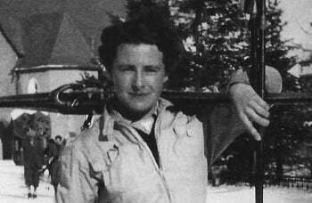
Fig 1. John Summers Drew (1879-1949). Compton near Winchester – being an Enquiry into the History of a Hampshire Parish by J.S.Drew. Published 1939 by Warren and Sons, Winchester, cover price 12/6
- John Summers Drew (1879-1949): a Neglected Hampshire Historian, by Barbara Turnbull in Volume 48 of the Proceedings of the Hampshire Field Club & Archaeological Society.
- The Society for All British and Irish Road Enthusiasts:

